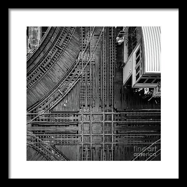
The Wells and Lake street intersection in the loop. Looking down on the complex railroad crossing of Chicago’s historic elevated train system, an abstract arrangement in black and white by Edward M. Fielding – prints available here: https://edward-fielding.pixels.com/featured/chicago-l-system-loop-crossing-edward-fielding.html
“What are you going to do today?” says my wife on her way to a seminar.
“I think I’m going to hang out downtown in a parking garage,” I say.
Oh, the look I got! But as a train buff and a photographer looking for a unique Chicago subject, spending hours in a downtown parking lot was a lot of fun.
The Loop (historically Union Loop, or commonly Loop) is the 1.79-mile (2.88 km) long circuit of elevated rail that forms the hub of the Chicago “L” system in Chicago, Illinois. As of 2012, the branch has served 74,651 passengers every weekday. The Loop is so named because the elevated tracks loop around a rectangle formed by Lake Street (north side), Wabash Avenue (east), Van Buren Street (south), and Wells Street (west). The railway loop has given its name to Chicago’s downtown, which is known as the Loop.
– Wikipedia